Magnetics
Magnetic prospection is based on measurement of the Earth’s natural magnetic field. Ferrous objects or other magnetic potent structures cause a measurable distortion (anomaly) of the Earth’s magnetic field.
Depth of penetration: about 5 m
Sample applications:
- Detection of hidden ferrous objects (e.g. barrels, drums, cable lines, ordnance, fundaments with armouring)
- Detection and limitation of old hidden waste landfills with magnetic potent substances
- Outline areas with demolition rubble in subsurface
- Lithological formation of subsurface in regions of crystalline bedrock
- Detection of fault zones especially in regions of crystalline bedrock
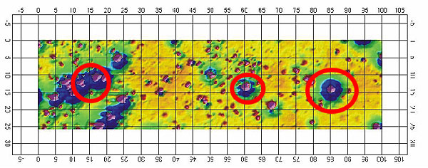
- Mapping of archaeological structures (furnaces, brick walls, streets, ditches, etc.)
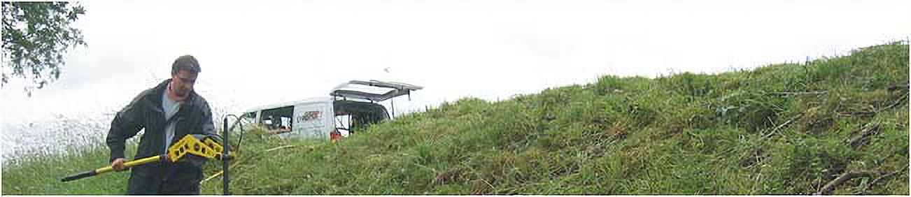
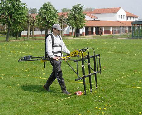
For fieldwork rectangular areas are marked out. The engineer paces these areas with the sensor in lines, to record a value every 10 to 30 cm. geoFact often uses arrays with three or four magnetic sensors to speed up measurement progress. In addition to digital fluxgate sensors (gradiometer) geoFact uses a state-of-the-art cesium magnetometer (total field magnetometer) and also owns a proton magnetometer.
Interpretation with newest software tools display anomalies in colours. In a further step, these anomalies serve information to model depth, size and weight of ferrous objects (e. g. UXO, unexploded ordnance).