Gravimetrie
Gravimetry is used to survey the gravity field of the Earth. A precondition to succeed is an exact altimetry.
Sample applications:
- Exploration of geological structure and lithological formation of subsurface
- Detection of fault zones especially in regions of crystalline bedrock
- Cavity detection
- Investigation of thickness/density of waste sites
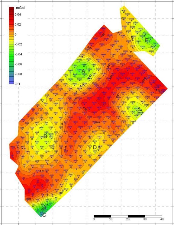
The gravimetric exploration delivers maps of local gravity fields. In the example, areas of low gravity acceleration are displayed in green. This example shows a micro-gravimetric exploration carried out for land development. Intention was finding karst cavities. In this display of the measured data, i. e. a map of Boguer gravity, one sees green areas of anomalies with low gravity values that indicate mass deficits and therefore possible cavities.