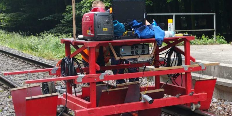
The company geoFact has been carrying out DGPS-supported track measurements with georadar for many years. The latest innovation is an automated image documentation of the measurement section. In this process, a photo of the measured section is taken at a specified distance, e.g. every 5 meters. This documentation facilitates the evaluation and interpretation of the georadar data, since disturbing objects on the surface can be immediately identified and assigned. The image data are made available to the client on request. This provides him with additional information on the current condition of the surveyed track.
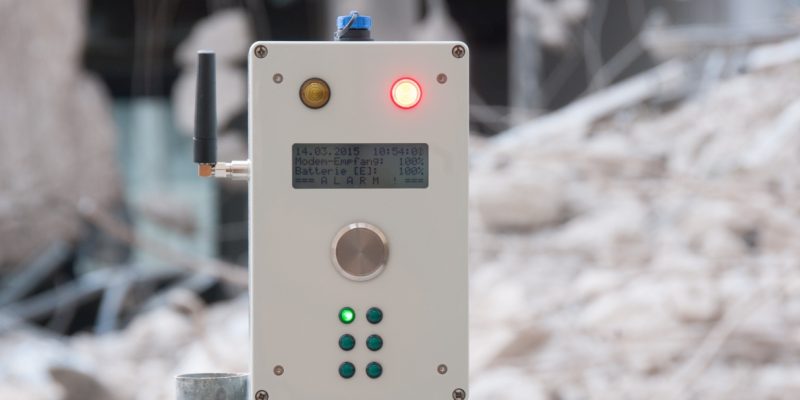
The company geoFact together with DMT GmbH & Co. KG has developed a wireless alarm box for vibration measurements.
Alarm box Mega RTG can be configured for all warning and alarm messages of the different measuring systems sent by SMS message. This solves for the first time the problem of incompatibility of alarm systems of the different manufacturers of vibration measurements. The alarm box replaces the - in the past often practiced - setting up of several alarm units for different measuring devices by being able to be used simultaneously for six different measuring devices.
The Mega RTG alarm box can, for example, be installed directly in the driver's cab in the excavator operator's field of vision. Both visual and acoustic warning and alarm messages can be set. Led lights indicate from which measuring station the warning/alarm has originated. The warning/alarm will not stop until it is acknowledged by pressing a button. All processes of the alarm box are documented internally in a protected log file.
The Alarmbox Mega RTG can, of course, also output warning and alarm messages for inclination and groundwater level sensors, as well as many other applications.
The Alarmbox Mega RTG can be ordered now from geoFact bestellt werden. Weitere Informationen erhalten Sie bei Dr. Heinrich Krummel.