GPR
GPR (Ground Penetrating Radar) methods allow near-subsurface exploration with high horizontal and vertical resolution. Electromagnetic radar waves are emitted in the subsoil, where they are reflected or scattered by buried objects. Common frequencies of GPR electromagnetic waves reach from megahertz (MHz) up to gigahertz (GHz) range.
Depth of penetration: (heavily dependent on subsurface) up to 10 m
Sample applications:
- Detection of pipes, cables and other man-made objects (e.g. barrels, fundaments)
- Detection of cavities
- Investigation of sediment and soil structures
- Detection of faults, fissures and cracks in bedrock
- Survey of road conditions (thickness of asphalt, foundations)
- Building analysis (cracks, armouring)
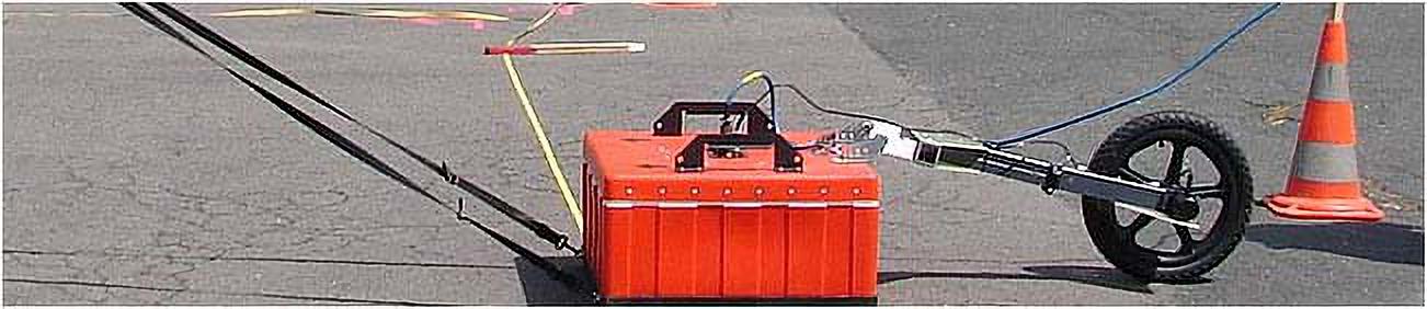
Depending on depth and resolution of the investigation area, an adequate measuring frequency is chosen. geoFact owns antennas of 200, 400 and 900 MHz. In the next step, the GPR is moved along profiles in the investigation area. A field computer allows realtime display of the results and a first evaluation of the measurement.
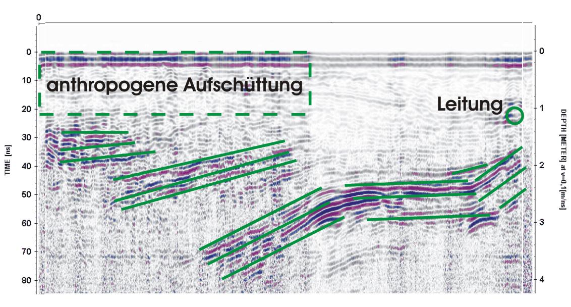
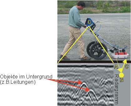
The resulting plots of a GPR measurement is a radargram, in which buried objects or layers can be identified by the reflected electromagnetic waves. In addition to a man-made deposit and a cable line the example also shows an interbedded strata of sands and clays.
Principle of a GPR survey
- Electromagnetic radar waves are emitted into the ground.
- This waves are reflected and scattered by objects, e.g. metallic bodies, pipe lines, fundaments, demolition rubble or variations in the subsurface.
- Reflected or scattered waves are received by the GPR instrument. Under good conditions (bad conductive dry materials) the depth of penetration is up to 10 m with high lateral and vertical resolution, when using antennas with 200 or 400 MHz. In wet or clayey soils with high electric conductivity depth of penetration is very low (several dm), but it is high in dry, sandy or rocky soils.
- A radargram can be viewed in real time on the display of the measuring device. So first analysis can already take place in the field.