")
Cavity Detection
The following example shows a successful cavity research by geoelectric profile measurements. The task was to find a 2 to 3 m sized near-surface marl adit where ancient farmers had mined calcareous soil. These “forgotten” marl adits nowadays cause hazards during land development.

Overall, there were measurements of 30 geoelectric profiles with 45 electrodes and spacings of 1.5 m in the investigated area. The profile displacment also was 1.5 m. Due to this minor electrode and profile distance very accurate vertical and horizontal resolution was attained.
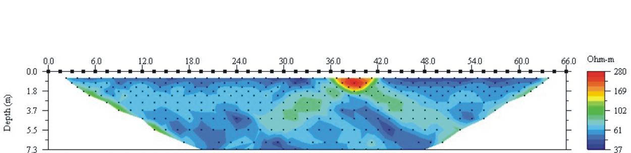
The adjacent image shows a geoelectric profile that was directly measured across the cavity. The red coloured cavity clearly appears as low electric conductive area at meter 37 to 41.
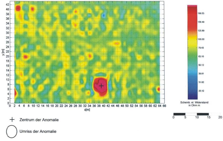
After interpretation of each profile the data of single depths were used to calculate depth slices of electric resistivity. At the depth slice of 2 m the marl adit is clearly visible as well.