


![]()
Geophysikalische Dienstleistungen
geoFact GmbH aus Bonn bietet ein breites Spektrum von geophysikalischer Messverfahren zur Lösung geologisch/geotechnischer Fragestellungen und zur Kampfmittelsuche an. Unsere Dienstleistungen umfassen die Messungen, Datenbearbeitung, Auswertung und Interpretation.
Mit der Erfahrung von über 20 Jahren lösen wir die Aufgaben unsere Kunden nicht nur im Raum Köln, Bonn, NRW, und Rheinland-Pfalz, sondern deutschlandweit.
Zu den von uns angewandten Methoden gehören Geoelektrik, Georadar, Magnetik, Seismik, Transient-Elektromagnetik, EM, Gravimetrie, Erschütterungs- und Pegelmessungen, sowie Monitoring.
geoFact bietet seinen Auftraggebern und Partnern eine stets dem neuesten Stand entsprechende Bearbeitung. Unser umfangreicher Messgerätepool wird regelmäßig gewartet und stetig um aktuelle Geräte erweitert.
Unser geoFact–Team aus qualifizierten und praxiserfahrenen Geophysiker, Geowissenschaftler und Geographen wächst seit der Gründung 2001 stetig. Aus diesem Grund können wir unseren Kunden immer zeitnah Termine anbieten. Zudem gewinnen wir durch unser neuen Mitarbeiter neue Kompetenzen und bleiben stest auf dem neusten Stand der Forschung.


-
Our Services
-
geoFact ensures that each measurement is performed contemporary and reliably in close arrangements with our principals and partners. A prompt project handling to the particular state of technique with modern measurement devices and newest software provides our clients with fast and precise results.
Seismik
Die Seismik basiert auf der Messung von Laufzeiten und Amplituden seismischer Wellen, die sich im Untergrund mit einer materialabhängigen Geschwindigkeit ausbreiten. Die seismischen Wellen werden z.B. mit einem Hammer, mit einem beschleunigten Fallgewicht oder auch mit Sprengstoff angeregt (seismische Quelle).
Mehr erfahren

Geoelektrik
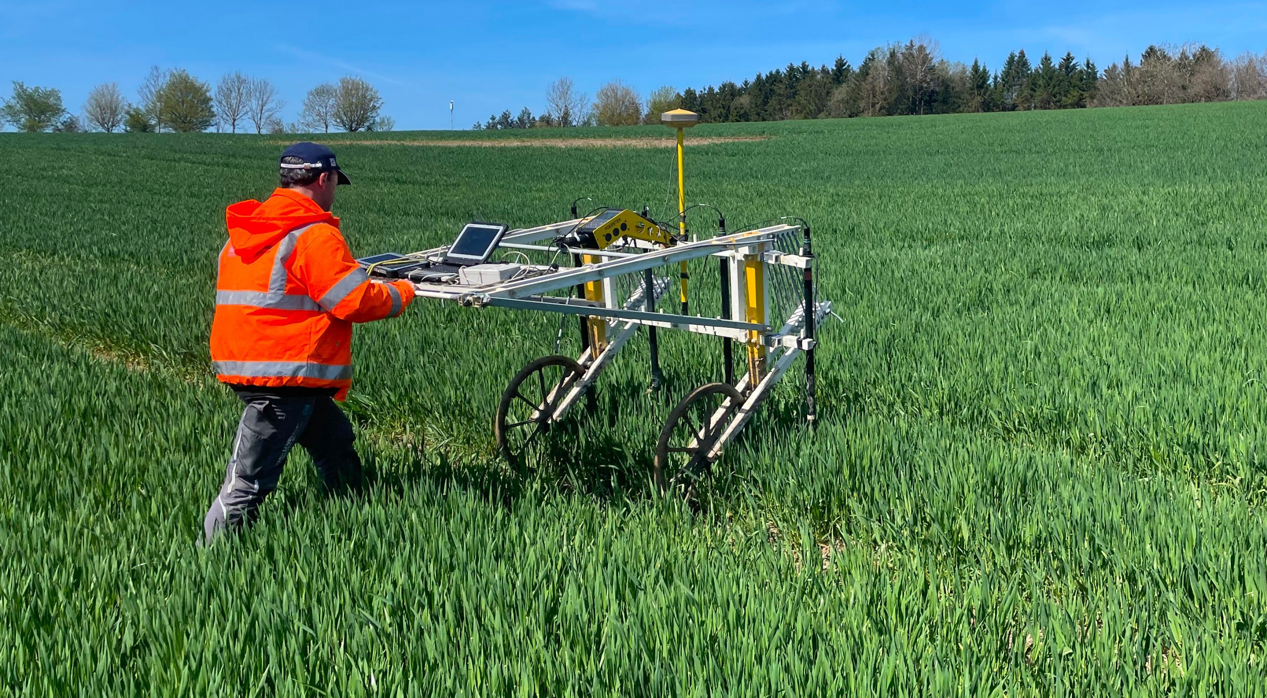
Mit geoelektrischen Verfahren wird der elektrische Bodenwiderstand des Untergrundes gemessen. Je nach Aufgabenstellung kommen folgende Messkonfigurationen zum Einsatz: geoelektrische Sondierungen, Kartierungen und die 2D/3D-Geoelektrik.
Mehr erfahren
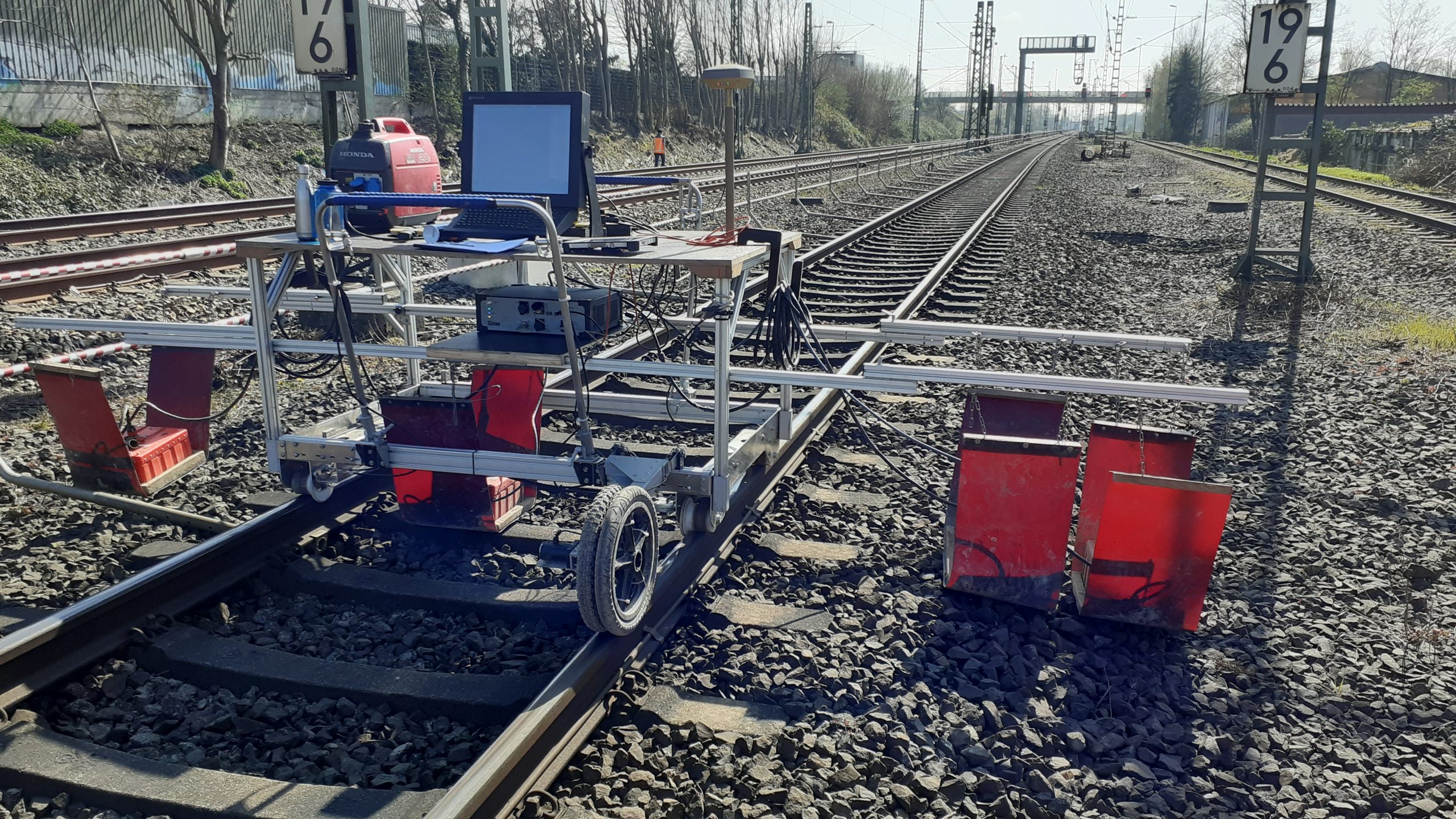
Georadar
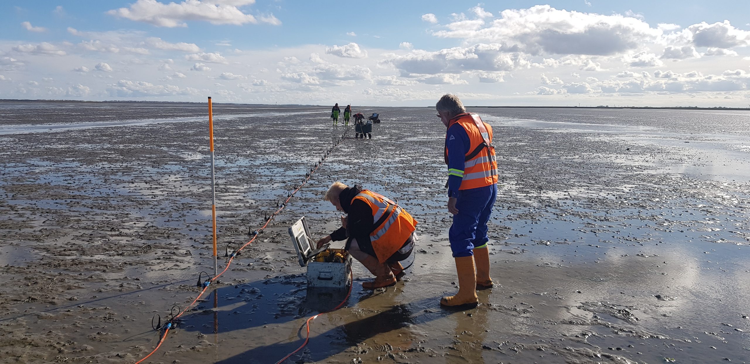
Das Georadar ermöglicht die Erkundung des oberflächennahen Untergrundes mit hoher horizontaler und vertikaler Auflösung. Bei der Messung werden elektromagnetische Radarwellen in den Boden abgestrahlt, die von Störkörpern reflektiert oder gestreut werden. Die elektromagnetischen Wellen liegen im Megahertz (MHz) bis Gigahertzbereich (GHz).
Mehr erfahren
Magnetik
Die magnetische Erkundung des Untergrundes basiert auf der Messung des natürlichen Magnetfelds der Erde. Eisenobjekte oder andere magnetisch wirksame Strukturen führen zu einer messbaren Verzerrung (Anomalie) des Erdmagnetfeldes.
Mehr erfahren

Elektromagnetik
Elektromagnetische Verfahren werden zur Ermittlung der elektrischen Leitfähigkeit des Untergrundes eingesetzt. Wir verwenden Zweispulen-Messsysteme die im Zeitbereich messen. (TEM - Transientenelektromagnetik).
Mehr erfahren
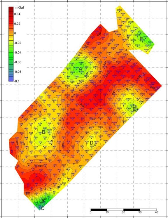
Gravimetrie
In der Gravimetrie wird das lokale Schwerefeld der Erde vermessen. Eine Voraussetzung bildet dabei die exakte Höhenmessung.
Mehr erfahren

Erschütterungsmessungen
Der Bau von Infrastruktureinrichtungen erfordert Eingriffe in den Untergrund, die mit Bodenerschütterungen verbunden sein können. Im schlimmsten Fall können dadurch Schäden an Gebäuden entstehen. Um z.B. späteren Streitigkeiten vorzubeugen, eignen sich kontinuierliche Erschütterungsmessungen während der Bauphase als Beweissicherungsmaßnahme.
Mehr erfahren

Pegelmessung
Unsere Monitoringsysteme zur Überwachung von Bächen und Rückhaltebecken bestehen aus einem autonomen Pegelsensor und einer solarbetriebenen Videokamera, die beide über LTE ihre Daten direkt auf unsere Server laden und dann über eine Webseite eingesehen werden können. Bei Überschreitung von bestimmten Pegelständen kann automatisch über Email oder SMS gewarnt werden.
Mehr erfahren

Monitoring
Bei vielen Infrastrukturprojekten gehört die Überwachung der benachbarten Bauwerke zu den elementaren Aufgaben um die Integrität dieser sicherzustellen und im Notfall rechtzeitig einschreiten zu können. geoFact Partner, Socotec Monitoring hat sich auf diese Überwachungtechnologien spezialisert und bietet ein weites Spektrum an kabellosen Sensoren an.
Mehr erfahren

Drohnen-Geophysik
Zur Exploration großer Flächen oder von Gebieten die schwer zugänglich sind, wie Moore, Gewässer, Gletscher oder Watt eignet sich der Einsatz von drohnengestützter Geophysik.
Mehr erfahren

Drohnen-Vermessung
Zusammen mit unseren Partnern von Socotec führen wir mit unseren Drohnen Photogrammmetrie und LiDAR Vermessungen durch.